Mopeka® Satellite
By Myriota®
Mopeka Satellite combines industry-leading tank and cathodic protection monitoring with next-generation 5G satellite connectivity, delivering near real-time visibility across assets — even beyond cellular coverage.
 Global connectivity via Myriota’s 5G NTN
 Engineered to survive submersion, impact, dust, and extreme temperatures
 Up to 10 years battery life from 2xAA user replaceable batteries
 High-precision GNSS tracking for superior accuracy
 Integrated accelerometer for movement alerts
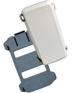
Mopeka Satellite – Where Accuracy Meets Global Connectivity
Mopeka Satellite is built for scale, reliability, and operational efficiency. Gain near real-time visibility across remote assets and improve supply chain performance with accurate, near real-time data — anywhere your tanks are located.
With native 5G Non-Terrestrial Network (NTN) connectivity, long-life power options, and rugged design, Mopeka Satellite provides global asset visibility and precision tank intelligence. Unlock new efficiencies, reduce runouts, and improve supply chain performance with accurate, near real-time data — anywhere your tanks are located.
Mopeka Satellite is a fully autonomous, maintenance-free solution designed for long-term remote deployment, delivering up to 10 years of operation. More than a device, it provides reliable, near real-time visibility into your assets anywhere in the world.
Benefits
Reduce runouts, optimize supply chain efficiency, and unlock new operational insights with continuous tank monitoring across global deployments.
- Global Coverage via 5G Satellite (NTN) – Reliable connectivity beyond terrestrial networks
- Engineered for Harsh Environments – Built for extreme temperatures, impact, dust, and submersion
- Flexible, Long-Life Power Options – Battery-powered configuration for multi-year deployment
- High-Precision Location Tracking – Integrated GNSS (~4m accuracy)
- Smart Monitoring & Alerts – Accelerometer-based movement detection and alerts
- Seamless Data Integration – Secure cloud APIs with JSON delivery
- Scalable Deployment – Designed for single sites to global fleets
| Technical Specifications | |
|---|---|
| CONNECTIVITY | Myriota HyperPulse™ 5G NTN (Satellite NB-IoT) |
| COVERAGE | Global, beyond terrestrial networks |
| NETWORK TYPE | Direct-to-satellite, low-power wide-area (LPWA) |
| LOCATION | GNSS positioning (~4 m accuracy) |
| REPORTING MODES | Scheduled, event-based, movement-triggered |
| MESSAGE HANDLING | Store-and-forward with intermittent connectivity support |
| SENSORS & INPUTS | Integrated accelerometer; digital inputs for external sensors |
| ALERTS | Movement detection, geofencing, exception-based alerts |
| POWER SOURCE | Long-life battery-powered |
| BATTERY LIFE | Up to 10 years (configuration dependent) |
| POWER OPTIMIZATION | Ultra-low power operation with adaptive reporting |
| DEPLOYMENT | Rapid install; no wiring, external power, or antennas required |
| Technical Specifications | |
|---|---|
| MOUNTING OPTIONS | Magnetic or fixed mounting configurations |
| ENVIRONMENT | Outdoor, remote, and harsh environments |
| INGRESS PROTECTION | IP68 / IP69K rated |
| DURABILITY | Impact, vibration, salt fog, humidity resistant |
| OPERATING TEMPERATURE | -40°C to +60°C |
| DIMENSIONS | 3.25 x 7 x 1.125 in (8.26 x 17.78 x 2.86 cm) |
| WEIGHT | 13.5 oz (385 g); 40.57 oz (1150 g) with mounting bracket |
| CERTIFICATIONS | FCC, CE, ATEX and global regulatory approvals |
| HAZARDOUS LOCATIONS | Intrinsically safe options (Zone 0 / Class I Div 1) |
| DATA INTEGRATION | Cloud platform with HTTPS / JSON API |
| SECURITY | 3GPP standards-based secure communication |
| FORM FACTOR | Compact, rugged, low-profile design |